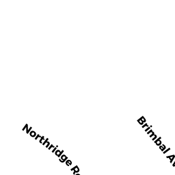
0 BRIMBAL AVE
Owner Information
ROUTE 128 LAND IRREVOCABLE TR
58 DUNHAM RD
BEVERLY, MA 01915


Property Details
0 BRIMBAL AVE is classified as a Potentially Developable Commercial Land.
0 BRIMBAL AVE is valued at $99,400. The land is valued at $99,400 and the structures are valued at $0.
This property is in Zone IR. Confirm with local Zoning Board authorities to ensure there are no overlays or other easements on this property.
The most recent deed for 0 BRIMBAL AVE is recorded at the local registrar in Book 40363, Page 216. 0 BRIMBAL AVE was last sold on Friday, October 8, 2021 for $1.
Assessment data from fiscal year 2022.
Flood Data
According to the FEMA National Flood Hazard Layer, this property does not appear to be in a flood zone. It may also be in an area not yet reviewed. Nonetheless, confirm this information prior to taking any action.
To view the flood hazards around this property, create a FEMA "Firmette" Map of the area around 0 BRIMBAL AVE.
Broadband Internet Providers
| Provider | Type | Bandwidth (mbps) | |
|---|---|---|---|
| Viasat Inc | Satellite | 100 | 3 |
| Verizon New England Inc. | DSL | 15 | 1 |
| Comcast | Cable | 1000 | 35 |
| MCI | Copper Wire | 0 | 0 |
| McLeodUSA Telecommunications Services, LLC | DSL | 0 | 0 |
| T-Mobile | Fixed Wireless | 25 | 3 |
| GCI Communication Corp. | Satellite | 0 | 0 |
| HughesNet | Satellite | 25 | 3 |
| VSAT Systems, LLC. | Satellite | 2 | 1 |
| Crown Castle Fiber | Fiber | 0 | 0 |
Broadband service provider data from December 2020.
Adjacent Properties
- 75 R BRIMBAL AVE
Nursing Homes - includes property designed for minimal care with or without medical facilities owned by CCP BLUEBERRY HILL 0581 LLC - 201 BROUGHTON DR
Apartments with More than Eight Units owned by BROUGHTON DRIVE OWNER LLC - 0 BRIMBAL AVE
Potentially Developable Commercial Land owned by ROUTE 128 LAND IRREVOCABLE TR - 115 BRIMBAL AVE
Electric Generation Plants owned by BWC RAMS HORN CHANNEL LLC - 111 BRIMBAL AVE
Vacant, Selectmen or City Council (Municipal) owned by CITY OF BEVERLY